The White Sea Coast: Petroglyphs, Labyrinths, Chupa
2 days · about 250 km · Republic of Karelia
Neolithic petroglyphs of Zalavruga, the port town of Kem, a sea trip to the Kuzova labyrinths and the northern shore at Chupa.
Description
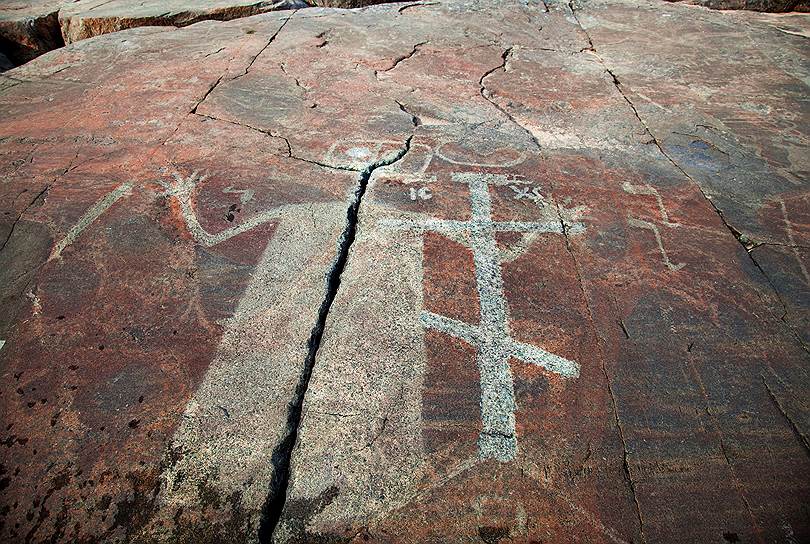
A two-day journey along the White Sea shore of Karelia, from Belomorsk northward: ancient rock carvings, an old port town, a short sea expedition to mysterious labyrinths and the edge of big water at Chupa. About two hundred and fifty kilometres by road, plus the sea trip to Kuzova — plan a spare day for it, as landings are cancelled in a swell. It starts with the Belomorsk petroglyphs near the village of Zalavruga, on Cape Besov Nos: thousands of images carved into granite around the fourth–third millennium BC — deer, boats, hunting scenes and mythological figures. This is an open archaeological landscape, access is organised along excursion routes; the carvings must not be touched, granite is slippery after rain, and midges call for face and hand protection. Next is Kem, one of the oldest towns of Karelia and the working base of the route: wooden houses, church buildings, the embankment of Kemskaya Guba and the piers from which sea runs depart. The main attraction is the Kuzova archipelago with dozens of stone labyrinths linked to the Early Iron Age; their purpose is still a matter of scholarly debate. The islands belong to a nature park: do not step on the walls, walk around the shores where birds nest, and book the trip in advance — places are few. The finale is Chupa in the Loukhsky district, one of the northernmost coastal points of the republic. No embankments here: a low rocky shore, wind from the sea all year round, fishermen in the bays. Take fuel and provisions in advance, mobile signal is unstable — that is the honest price of a northern horizon with the sea still beyond it.
Route points
- 1Belomorsk Petroglyphs
Neolithic rock art at Besov Nos cape — among the largest prehistoric art sites on the Russian North.
- 2Kem White Sea Port
Old White Sea port town.
- 3Kuzova Stone Labyrinths
Ancient stone labyrinths on the Kuzova archipelago off Kem — a sea route to Early Iron Age enigmatic structures.
- 4Chupa White Sea Coast
Northern White Sea shore at Chupa.