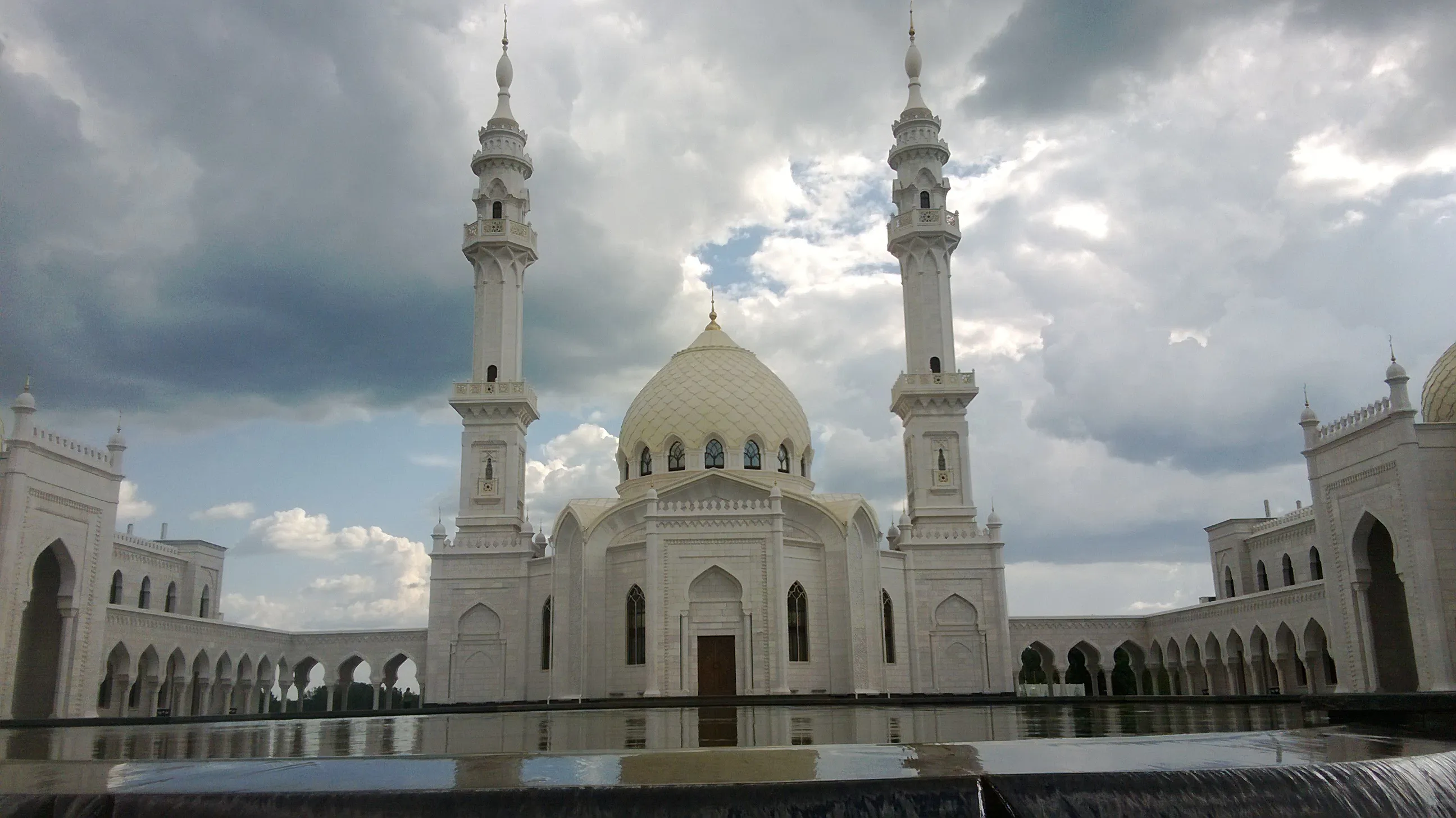
Bolgar — Kama Mouth: Volga Frontier
1 day · about 55 km · Republic of Tatarstan
Bolgar settlement, Kamskoye Ustye, Lobach Mountain and Yuryevskaya Cave: a day between World Heritage and the panorama of two great rivers confluence.
Description
A one-day route through the southwest of Tatarstan, where Volga history reads in layers: the capital of Volga Bulgaria, a settlement at the confluence of Kama and Volga, a landslide mountain with a panorama, and a gypsum cliff cave. About fifty-five kilometers in a straight line, but the Volga divides the route — plan transfers in advance, relying on navigation and crossings. Start at the Bolgar settlement on the high Volga bank: Bolgar appeared here in the tenth century and became, according to academic Yanin, "the only gates through which Rus trade went with the East". In 922, an embassy from the Baghdad caliph arrived with secretary Ahmad ibn Fadlan — from this moment the Bulgars accepted Islam; the city survived the 1361 rout, but after the 1431 strike was abandoned forever. Today it is the largest archaeological complex of the Volga region — the Cathedral Mosque, mausoleums, the Khan's tomb, baths with a heating system — a UNESCO World Heritage site since 2014, and nearby stands the 2012 White Mosque, controversial but a recognizable symbol of the complex. Further along the route to Kamskoye Ustye — a settlement from 1650, founded as Bogorodskoye village, standing opposite the confluence of the Volga and Kama. Here the pier accepts cruises, the ferry crossing operates, and on the slope to the river flows the "Holy Well" spring, known since the nineteenth century. From here roads diverge to the main points of the Volga region — and the first of them is Lobach Mountain: a 136-meter rock outlier, a landscape reserve since 1991, where two complete mammoth skeletons were found in the ravine, thirteen archaeological monuments on the slopes, and in 1870 Ilya Repin made sketches for "Barge Haulers on the Volga". From the summit — that very panorama where the two rivers become one. Finish at Yuryevskaya Cave in Bogorodskiye Gory, the longest natural cave of the Middle Volga: about a kilometer of passages in gypsum, blind wells, gypsum outcrops, and "shelves". It is open from the riverbank cliff of the Volga, a nature monument since 1986; inside it is cool, wet and dark, passages are sometimes crawling, so people come here with headlamps, helmets and an experienced partner — an honest point for those who want to finish the day with the underground part of the Volga bank.
In catalog since November 7, 2026
Route points
- 1Bolgar Historical Complex
Capital of Volga Bulgaria and one of the largest cities of the Golden Horde on the Volga, abandoned in the fifteenth century: white-stone ruins of mosques, mausoleums and baths, a World Heritage site since 2014.
- 2Kamskoye Ustye
A settlement of 1650 at the point where the Kama joins the Volga: a river pier, the 'Holy Well' spring known since the nineteenth century, and the gateway to the Volga's right bank — to Lobach hill and the Yuryevskaya cave.
- 3Lobach Hill
A remnant hill above the Kama mouth — a landscape reserve since 1991: landslide bluffs, rare plants, mammoth skeletons found in the ravine and the finest panorama of two great rivers merging.
- 4Yuryevskaya Cave
The longest natural cave of the Middle Volga — about a kilometre of passages in the gypsum of the Bogorodsky hills above the Volga, a protected natural monument since 1986.